File:Occitania blank map.PNG: Difference between revisions
imported>Caesar Schinas m (Robot: Changing template: GFDL) |
imported>Caesar Schinas m (Bot: Replace Template:Image_notes_* with Template:Image_Details) |
||
| Line 1: | Line 1: | ||
== Summary == | == Summary == | ||
{{ | {{Image_Details | ||
| | | description = Correct map of Occitania (green area) with state boundaries | ||
| | | author = Norrin Strange {{#if:http://gl.wikipedia.org/wiki/Usuario:Norrin_strange|(http://gl.wikipedia.org/wiki/Usuario:Norrin_strange)}} | ||
| copyright = Norrin Strange | |||
| | | source = http://commons.wikimedia.org/wiki/Image:Occitania_blanck_map.PNG | ||
| | | date-created = 14-07-2007 | ||
| | | pub-country = | ||
| | | notes = | ||
| versions = | |||
}} | |||
== Licensing/Copyright status == | == Licensing/Copyright status == | ||
{{GNU|FDL|1.2|+}} | {{GNU|FDL|1.2|+}} | ||
Revision as of 02:54, 22 June 2009
Summary
| Title / Description
|
Correct map of Occitania (green area) with state boundaries |
|---|---|
| Author(s)
|
Norrin Strange (http://gl.wikipedia.org/wiki/Usuario:Norrin_strange) |
| Copyright holder
|
Norrin Strange See below for license/re-use information. |
| Source
|
http://commons.wikimedia.org/wiki/Image:Occitania_blanck_map.PNG |
| Date created
|
14-07-2007 |
| Country of first publication
|
Please edit this page and add the country of first publication, or note that it is unknown. |
| Notes
|
You can edit this page and add notes here which may be useful to people who wish to re-use this media. |
| Other versions
|
If there are other versions of this media on CZ, please list them here. |
| Using this image on CZ
|
, then copy the code below to add this image to a Citizendium article, changing the size, alignment, and caption as necessary.
|
Please send email to manager A T citizendium.org .
Licensing/Copyright status
Occitania blank map.PNG is licenced under the GNU Free Documentation License v1.2 or later
Permission is granted to copy, distribute and/or modify this document under the terms of the GNU Free Documentation License, version 1.2 or any later version published by the Free Software Foundation; with no Invariant Sections, no Front-Cover Texts, and no Back-Cover Texts.
Read the licence for full details
Notice of CC-by-sa incompatibility
Text on the Citizendium is licensed under the Creative Commons Attribution ShareAlike licence.
This media may not be used under those or closely similar terms without separate permission of the copyright holder, or the user's own fair use determination.
File history
Click on a date/time to view the file as it appeared at that time.
| Date/Time | Thumbnail | Dimensions | User | Comment | |
|---|---|---|---|---|---|
| current | 19:58, 11 March 2022 | 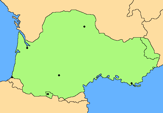 | 573 × 397 (11 KB) | Maintenance script (talk | contribs) | == Summary == Importing file |
You cannot overwrite this file.
File usage
The following page uses this file: