File:5 Boroughs Labels New York City Map Julius Schorzman.png

From Citizendium
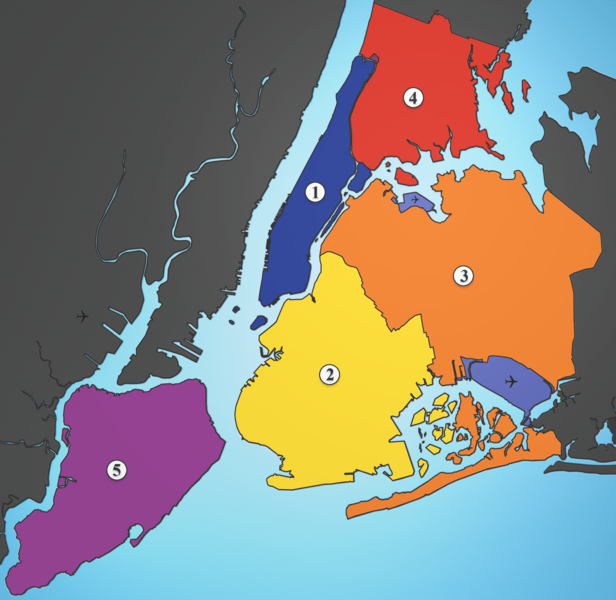
Revision as of 12:48, 11 July 2007 by imported>Kjetil Ree ({{ Information |Description= A map showing the five boroughs of New York City, as well as airports. # Manhattan # Brooklyn # Queens # Bronx # Staten Island Airports: North East: LGA; South East: JFK; West: EWR |Source= http://commons.wikimedia.org/wiki/Image:5_Boroughs_Labels_New_York_City_Map_Julius_Schorzman.png |Date= 19 August 2005 |Author= Julius Schorzman |Permission= Creative Commons Attribution ShareAlike 2.5 |other_versions= }})
(diff) ← Older revision | Latest revision (diff) | Newer revision → (diff)
Jump to navigation Jump to search

5_Boroughs_Labels_New_York_City_Map_Julius_Schorzman.png(616 × 600 pixels, file size: 300 KB, MIME type: image/png)

Summary

Template:Information

Licensing/Copyright status

Template:Cc-by-sa-2.5

File history

Click on a date/time to view the file as it appeared at that time.

Date/TimeThumbnailDimensionsUserComment
current19:57, 11 March 2022Thumbnail for version as of 19:57, 11 March 2022616 × 600 (300 KB)Maintenance script (talk | contribs)== Summary == Importing file

The following 2 pages use this file:

Metadata