File:A French Map With Sea of Korea.jpg
A_French_Map_With_Sea_of_Korea.jpg (315 × 393 pixels, file size: 68 KB, MIME type: image/jpeg)
| Title / Description
|
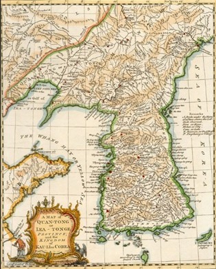
Title: "Carte de la province de Quan-tong ou Lyau-tong et du royaume de Kau-li ou Coree, copiee sur la carte angloise." |
|---|---|
| Author(s)
|
Tomas Kitchin |
| Copyright holder
|
N/A See below for license/re-use information. |
| Source
|
http://www.seaofkorea.org/bbs/map_5.php |
| Date created
|
1757 |
| Country of first publication
|
France |
| Notes
|
You can edit this page and add notes here which may be useful to people who wish to re-use this media. |
| Other versions
|
If there are other versions of this media on CZ, please list them here. |
| Using this image on CZ
|
Copy the code below to add this image to a Citizendium article, changing the size, alignment, and caption as necessary.
|
Please send email to manager A T citizendium.org .
Licensing/Copyright status
This media, A French Map With Sea of Korea.jpg, is in the public domain
Any copyright on this work has expired.
This applies to in the European Union, the United States, Canada, and other countries with a copyright term of life of the author plus 70 years.
You may freely copy, distribute, display and perform this work, as well as make derivative and commercial works.
File history
Click on a date/time to view the file as it appeared at that time.
| Date/Time | Thumbnail | Dimensions | User | Comment | |
|---|---|---|---|---|---|
| current | 19:54, 11 March 2022 | | 315 × 393 (68 KB) | Maintenance script (talk | contribs) | == Summary == Importing file |
You cannot overwrite this file.
File usage
The following page uses this file: