File:USA-expansion.png
Jump to navigation
Jump to search
Size of this preview: 789 × 600 pixels. Other resolution: 1,164 × 885 pixels.
Original file (1,164 × 885 pixels, file size: 146 KB, MIME type: image/png)
Summary
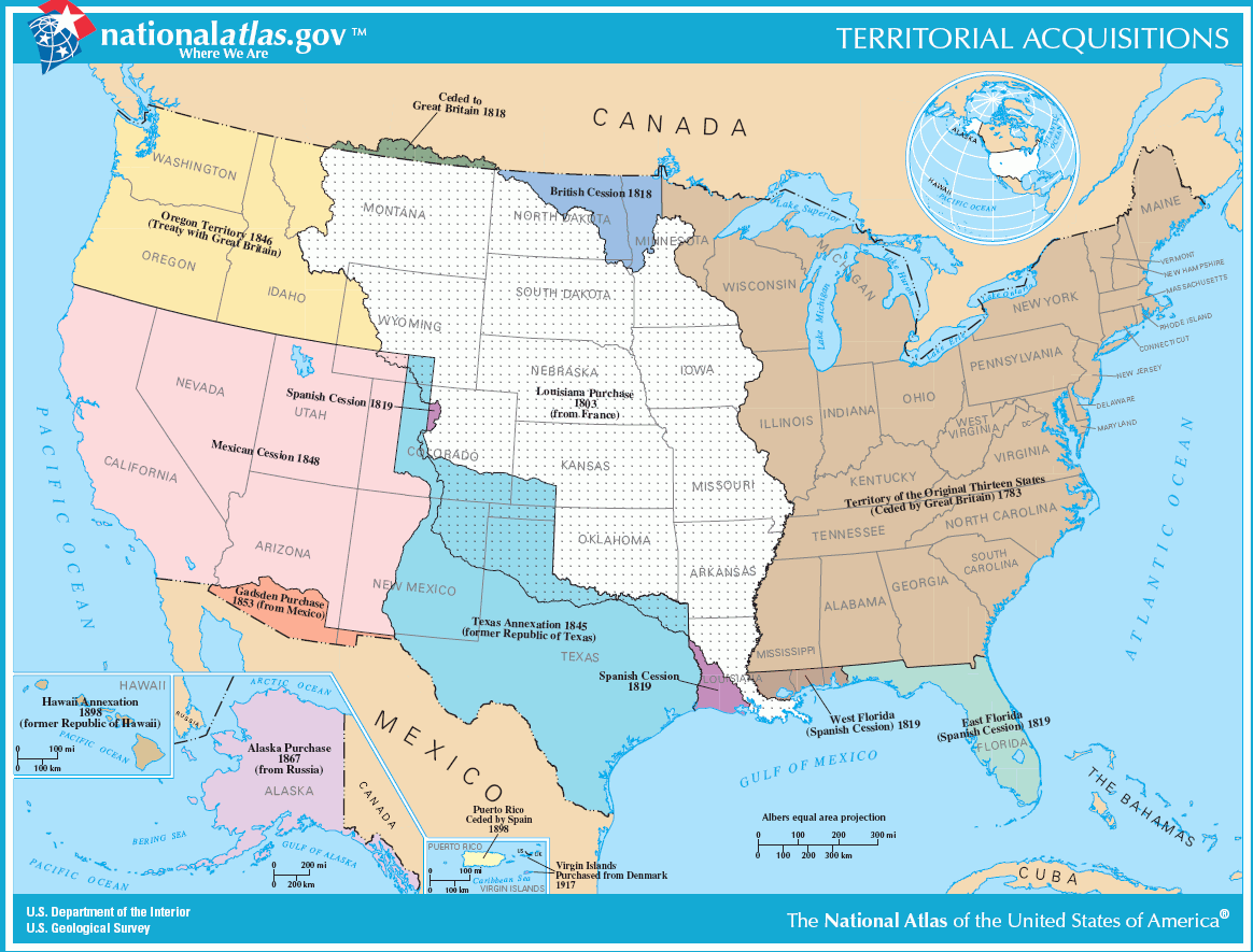
| Title / Description
|
A map of U.S. territorial expansion. |
|---|---|
| Author(s)
|
United States Geological Survey |
| Copyright holder
|
Public Domain See below for license/re-use information. |
| Source
|
Screen capture of pdf image from online National Atlas |
| Date created
|
2005 |
| Country of first publication
|
United States |
| Notes
|
You can edit this page and add notes here which may be useful to people who wish to re-use this media. |
| Other versions
|
If there are other versions of this media on CZ, please list them here. |
| Using this image on CZ
|
, then copy the code below to add this image to a Citizendium article, changing the size, alignment, and caption as necessary.
|
Image issue? Contact us via the email below.
Please send email to manager A T citizendium.org .
Licensing/Copyright status
Public domain; work of the U.S. Government
Licensing/Copyright status
This media, USA-expansion.png, is in the public domain
You may freely copy, distribute, display and perform this work, as well as make derivative and commercial works.
File history
Click on a date/time to view the file as it appeared at that time.
| Date/Time | Thumbnail | Dimensions | User | Comment | |
|---|---|---|---|---|---|
| current | 19:57, 11 March 2022 | | 1,164 × 885 (146 KB) | Maintenance script (talk | contribs) | == Summary == Importing file |
You cannot overwrite this file.
File usage
The following 2 pages use this file: