File:Map north america 1755 1760.jpg: Difference between revisions
Jump to navigation
Jump to search
imported>Jacob F. Roecker (Image of a Map of the British Colonies between 1755 and 1760. Obtained from the Library of Congress and uploaded by User:Jacob F. Roecker, released to the Public Domain.) |
(== Summary == Importing file) Tag: Server-side upload |
||
| Line 1: | Line 1: | ||
== Summary == | |||
Importing file | |||
Latest revision as of 19:56, 11 March 2022
Summary
Importing file
File history
Click on a date/time to view the file as it appeared at that time.
| Date/Time | Thumbnail | Dimensions | User | Comment | |
|---|---|---|---|---|---|
| current | 19:56, 11 March 2022 | 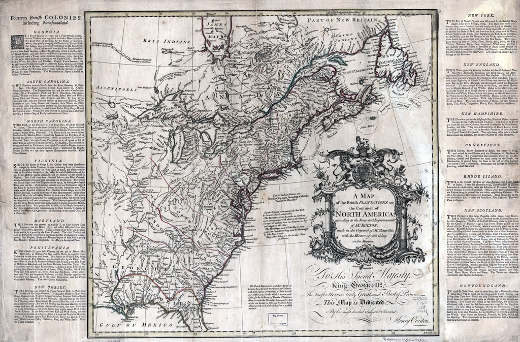 | 1,024 × 673 (276 KB) | Maintenance script (talk | contribs) | == Summary == Importing file |
You cannot overwrite this file.
File usage
The following page uses this file: