File:NativeTowns Pittsburgh.png: Difference between revisions
Jump to navigation
Jump to search
imported>Tom Cool (From Wikicommons. I created this map. Original notes below: ==Description== Native American towns and other points of interest regarding Native Americans, upper Ohio valley, Pittsburgh, Pennsylvania. Includes Meadowcroft Rockshelter, Sawcunk, Logstown, Indian Mound, The Point, Shannopin's Town, Chartier's Town and Kittanning. Also shows Youghiogheny River, Allegheny River, Beaver River and Ohio River. Positions determined by descriptions found in "Course of study in geographic, biograph...) |
(== Summary == Importing file) Tag: Server-side upload |
||
| Line 1: | Line 1: | ||
== Summary == | |||
Importing file | |||
== | |||
Latest revision as of 19:56, 11 March 2022
Summary
Importing file
File history
Click on a date/time to view the file as it appeared at that time.
| Date/Time | Thumbnail | Dimensions | User | Comment | |
|---|---|---|---|---|---|
| current | 19:56, 11 March 2022 | 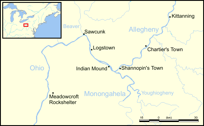 | 713 × 441 (52 KB) | Maintenance script (talk | contribs) | == Summary == Importing file |
You cannot overwrite this file.
File usage
The following 2 files are duplicates of this file (more details):
- File:NativeTowns Pittsburgh.png from a shared repository
- File:NativeTowns Pittsburgh.png from Wikimedia Commons
The following page uses this file: