File:Thatcher-Peninsula, South Georgia.jpg: Difference between revisions
Jump to navigation
Jump to search
imported>George Swan ({{Image notes |Description=Satellite image of central South Georgia Island: Cumberland Bay; Thatcher Peninsula with King Edward Cove (Grytviken); Allardyce Range with the summit Mt. Paget. Image Science and Analysis Laboratory, NASA-Johnson Space Center. 25 Mar. 2005. "Astronaut Photography of Earth - Display Record. |Author=unknown |Date=unknown |Source=http://eol.jsc.nasa.gov/scripts/sseop/photo.pl?mission=ISS011&roll=E&frame=12148 |Country first published in=USA |Copyright holder=[[NASA]...) |
imported>Caesar Schinas m (Replace Pd-USgov by PD-USgov) |
||
| Line 12: | Line 12: | ||
|Other versions=}} | |Other versions=}} | ||
== Licensing/Copyright status == | == Licensing/Copyright status == | ||
{{ | {{PD-USgov}} | ||
Revision as of 03:15, 28 May 2009
File history
Click on a date/time to view the file as it appeared at that time.
| Date/Time | Thumbnail | Dimensions | User | Comment | |
|---|---|---|---|---|---|
| current | 19:57, 11 March 2022 | 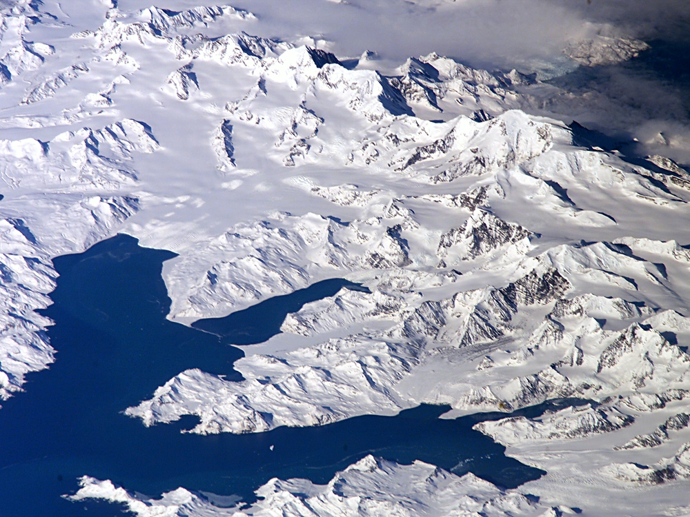 | 1,000 × 750 (660 KB) | Maintenance script (talk | contribs) | == Summary == Importing file |
You cannot overwrite this file.
File usage
The following 2 files are duplicates of this file (more details):
- File:Thatcher-Peninsula.jpg from a shared repository
- File:Thatcher-Peninsula.jpg from Wikimedia Commons
The following page uses this file: