File:San Fernando Mission Aerial View 1900s.jpg: Difference between revisions
Jump to navigation
Jump to search
imported>Robert A. Estremo ({{Image_Details|pd |description = An aerial view of the original chapel structure (middle) as well as the 'c'onvento'' building (bottom), and its surrounding land. |author = Unknown |source = Los Angeles Department of Water and Power |date-created = ''circa'' 1920 |pub-country = United States |notes = Aerial view of the original chapel structure (middle) as well as the Convento Building (bottom), and its surrounding land. Photograph shows a small section of Brand Park an...) |
(== Summary == Importing file) Tag: Server-side upload |
||
| Line 1: | Line 1: | ||
== Summary == | == Summary == | ||
Importing file | |||
Latest revision as of 19:52, 11 March 2022
Summary
Importing file
File history
Click on a date/time to view the file as it appeared at that time.
| Date/Time | Thumbnail | Dimensions | User | Comment | |
|---|---|---|---|---|---|
| current | 19:52, 11 March 2022 | 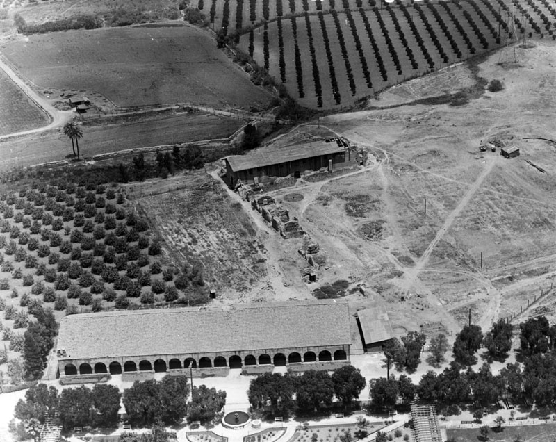 | 800 × 636 (175 KB) | Maintenance script (talk | contribs) | == Summary == Importing file |
You cannot overwrite this file.
File usage
The following page uses this file: