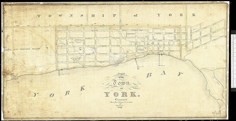
File:Old map of York, Upper Canada, 1827, Chewett, NMC16819.jpg
Jump to navigation
Jump to search
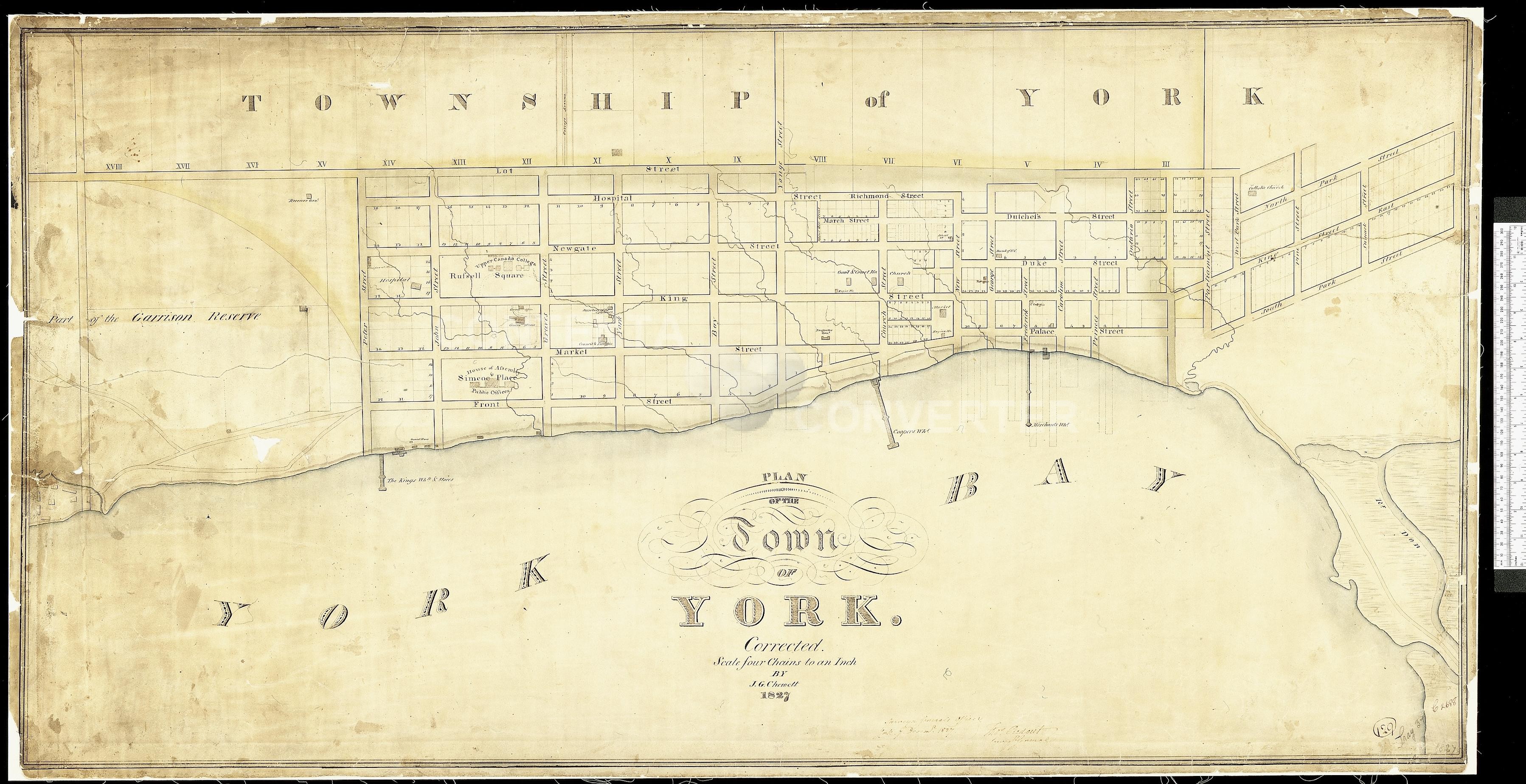
Size of this preview: 800 × 411 pixels. Other resolution: 3,595 × 1,848 pixels.
Original file (3,595 × 1,848 pixels, file size: 1.49 MB, MIME type: image/jpeg)
| Description | Old map of York, Upper Canada, 1827, Chewett | |||
| Date | ||||
| Source | http://oldtorontomaps.blogspot.ca/2013/01/1827-chewett-plan-of-town-of-york.html | |||
| Author | James Grant Chewett | |||
| Permission (Reusing this file) |
|

| Annotations | This image is annotated: View the annotations at Commons |
File history
Click on a date/time to view the file as it appeared at that time.
| Date/Time | Thumbnail | Dimensions | User | Comment | |
|---|---|---|---|---|---|
| current | 19:45, 6 June 2017 | | 3,595 × 1,848 (1.49 MB) | imagescommonswiki>Geo Swan | {{Information |Description=Old map of York, Upper Canada, 1827, Chewett |Source=http://oldtorontomaps.blogspot.ca/2013/01/1827-chewett-plan-of-town-of-york.html |Date=1827 |Author=James Grant Chewett |Permission={{PD-Canada}} |other_versions= }} [[Ca... |
File usage
The following file is a duplicate of this file (more details):
- File:Old map of York, Upper Canada, 1827, Chewett, NMC16819.jpg from Wikimedia Commons
The following page uses this file: