File:Cienaga, Magdalena, Colombia - Ciudad Perdida trek 78.jpg

Original file (2,376 × 1,584 pixels, file size: 2.34 MB, MIME type: image/jpeg)
Summary
| Description |
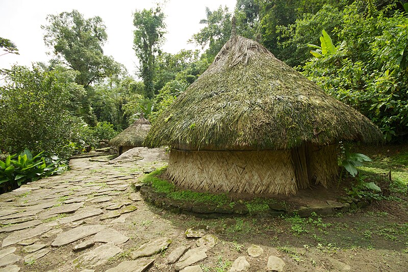
English: Cienaga, Magdalena, Colombia Circular stone terraces are one of the key features of the Teyuna "Lost City" site. Numbering over 250, most are still buried in the surrounding jungle. Each terrace would have once held a wood and thatch hut for family, work, or ceremonial use. These huts represent what would have been on each terrace circle. They are the same still used by the indigenous Tayronan tribes of the region, although notably, the tribes today have long lost the art of stone crafting and only terrace to a much more limited degree than at the height of their culture 500 years ago. |
| Date | |
| Source | https://www.flickr.com/photos/mckaysavage/10551925986/ |
| Author | McKay Savage |
| Camera location | | View this and other nearby images on: OpenStreetMap |
|---|
Licensing
- You are free:
- to share – to copy, distribute and transmit the work
- to remix – to adapt the work
- Under the following conditions:
- attribution – You must give appropriate credit, provide a link to the license, and indicate if changes were made. You may do so in any reasonable manner, but not in any way that suggests the licensor endorses you or your use.
| This image was originally posted to Flickr by mckaysavage at https://flickr.com/photos/56796376@N00/10551925986. It was reviewed on 9 June 2023 by FlickreviewR 2 and was confirmed to be licensed under the terms of the cc-by-2.0. |
File history
Click on a date/time to view the file as it appeared at that time.
| Date/Time | Thumbnail | Dimensions | User | Comment | |
|---|---|---|---|---|---|
| current | 09:40, 9 June 2023 | | 2,376 × 1,584 (2.34 MB) | imagescommonswiki>Myotus | Uploaded a work by McKay Savage from https://www.flickr.com/photos/mckaysavage/10551925986/ with UploadWizard |
File usage
The following file is a duplicate of this file (more details):
- File:Cienaga, Magdalena, Colombia - Ciudad Perdida trek 78.jpg from Wikimedia Commons
The following page uses this file: